
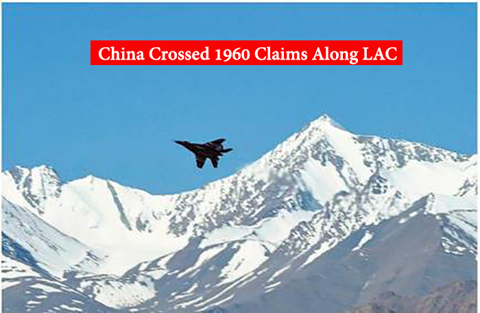
LAC stands for the Line of actual control; this line of actual control was decided back in the year 1960, but the Chinese troops are now breaking that line and at present and for now they have captured the area around the North bank of Pangong Lake that lies somewhere in Ladakh and that is for sure very much beyond the official boundary of china as given in the official records.
The Chinese tent set on the bank of Galwan River gave a trigger to the violence between the Chinese and the Indian soldiers on the 15th of June, in this violence India lost 20 brave soldiers and also an unknown number of Chinese soldiers died because of that.
The official records of 1960 are very clearly contradicting the present claims of China that are being made on LAC. In the year 1960 India saw a clear presence of china in the areas where PLA that is the People’s Liberation Army claimed in May and it was beyond the territory of Beijing. On this matter, the former foreign secretary and china’s brand ambassador Nirupama Rao said: “ The Chinese are now likely interpreting their perception of the LAC in a manner that seeks to redefine or maximise old claims along new lines, as cartography and terrain knowledge have improved, which offer them tactical advantage and more ‘domination’ in key areas along the LAC.”
If we get into the details of movements made by PLA that they came up to finger 4 and hence prohibited India from crossing it, the fingers here symbolize the mountain spurs on the bank of the river.
As per the Indian records, the Line of Actual Control is at finger 8 whereas China is now claiming it to be at finger 4. In the previous year’s china dominated the area up to the forth finger and also built a road up to finger 4 in the year 1999, but in May 2020 China cut off India’s claims to its LAC up to finger 8 and has further stretched line up to 8 KM in the west.
But as per the new update some meetings were conducted at the corps commander level and then the PLA moved back from Finger 4 to 5 and also the Indian troops moved back to the west up to finger 2.
The moves of china are increasing the war tension between both the nations as China is trying to violate its claims that it made about the boundary of Beijing in both the Galwan valley and the Pangong Lake in the year 1960.
As per the MEA report, all the official records maintained during the negotiations about the borders in the year 1960 are safe and sound available with the government of India and the people’s republic of China. These records were published by the Ministry of external affairs.
After the talks that were held regarding the border claims in the year, 1960 failed between the then prime minister, of India that is Jawaharlal Nehru and the premier of china “Zhou Enlai” failed then it was decided that both of them would be meeting again for checking the facts about the possessions of both the countries.
Later on, three sessions of meetings were held 2 in China and one in the National capital of India that is Delhi. After 3 long sessions of 18, 19, and then 10 meetings, the final result came out of the last session of10 meetings that were held in Rangoon. Then on December 12 1960 an official report was signed as per that report the Indians asked: “What was the exact point where the alignment cuts the western half of Pangong Lake? And what was the exact point where it left the Pangong Lake?” to which the Chinese responded by saying” “The coordinates of the point where it reached the Pangong Lake were Longitude 78 degrees 49 minutes East, Latitude 33 degrees 44 minutes North.”As per that the area falls somewhere around finger 8 somewhere around 8 kilometers of the east that is where China is now claiming the LAC to be.
If we get into the official understanding made in 1960 about the Galwaan Valley then that was India asked china “heights of peaks and locations of passes” to which China responded by saying “crossed the Galwan river at Longitude 78 degrees 13 minutes East, Latitude 34 degrees 46 minutes North.”But now China is trying to go beyond the claims that we’re settled back in the year 1960 both in regard to the Pangong Lake and also the Glawan Valley.
Even if one goes as per approximations taking the coordinates as round numbers noted with the SI unit of degrees and minutes, still claims of China are going very much beyond the official reports that were signed in the year 1960 by the then governments of both the countries.
Now that is to be seen is that, at what point and when this tension going on between the two countries would come to a peaceful conclusion and where would that conclusion further take the fate of both the countries. In these times when the whole world is already struggling to fight with the pandemic such war tensions are doing nothing except for increasing the challenges and problems. All one can do is pray for peace and hope so that everything around the world gets back on the track.